Categories
Categories
- $1 Items
- Digitally Archived Documents
- Downloadable Maps
- DVD's and Video's
- Geology and Ore Deposits
- History
- Jewelry Gems Lapidary
- Lode Mining
- Metal Detecting
- Mineral Processing & Metallurgy
- Mining & Geology
- New
- No Category
- Placer Mining
- Prospecting and Exploration
- Publications by Country
- Publications By State
- Rare and Out of Print
- Treasure Hunting
- Home
- Digitally Archived Documents
- Tertiary Gold Bearing Channel Gravel California Mining
Tertiary Gold Bearing Channel Gravel California Mining
$3.95
Product Description
Rare Publications on Ebook
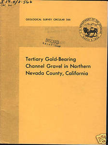
Tertiary Gold-Bearing Channel Gravel in Northern Nevada County, California
Geological Survey Circular 566 - 1968
Here is a great study done by the USGS on the Motherlode! Complete with Maps and Diagrams!
Contents Include:
-
Abstract
-
Geology of the Channel Gravel
-
Introduction
-
-
Previous work
-
Acknowledgments
-
-
General Geology
-
-
Bedrock
-
Auriferous Gravel
-
Volcanic Rocks
-
Colluvium
-
-
Tertiary Channel Near North Columbia
-
-
Configuration of the Channel
-
Grade and Distribution of gold
-
-
Geophysical Investions of the channel gravel
-
-
Introduction
-
Acknowledgements
-
-
Instrumentation and Field Procedures
-
Determination of Bedrock Configuration
-
-
Seismic Method
-
Gravity Method
-
Magnetic Method
-
Resistivity Method
-
Electromagnetic Method
-
Induced - Polarization Method
-
-
Detection of Tertiary channels under volcanic cover
-
Recognition and delineation of the blue gravel
-
Location of concentrations of magnetic minerals
-
Conclusions
-
References Cited
Figures
- Index Map showing loation of area studied
- Geologic map of part of area between the South and Middle Yuba Rivers
- Diagram showing inferred path followed by the Tertiary Yuba River
- Diagrammatic section across and idealized Tertiary channel
- Detailed Geologic map showing location of hydraulic pits and drill holes in the Tertiary gravel in the vicinity ofn North Columbia and Badger Hill
- Subsurface Contour map of bottom of channel near North Columbia as indicated by drill holes
- Cross Section o channel near North Columbia as indicated by one line of drill holes
- Contour map of the foot-assay product as indicated by drilling information
* This document was digitally archived by Sylvanite, Inc. and is not to be used for resale or reproduction. You are not purchasing the original document but a PDF format available for instant download upon purchase.


 Loading... Please wait...


